Waking up on Sunday morning for my second full day in Mauritius – I knew this was a big day. Mauritius is famous for its beaches, but that’s not what I was there to do.
The owner of the place I was staying at had mentioned that Gris Gris Beach was a short walk away. Seeing as the beach is the most southern tip of the island, I thought I better check it out.
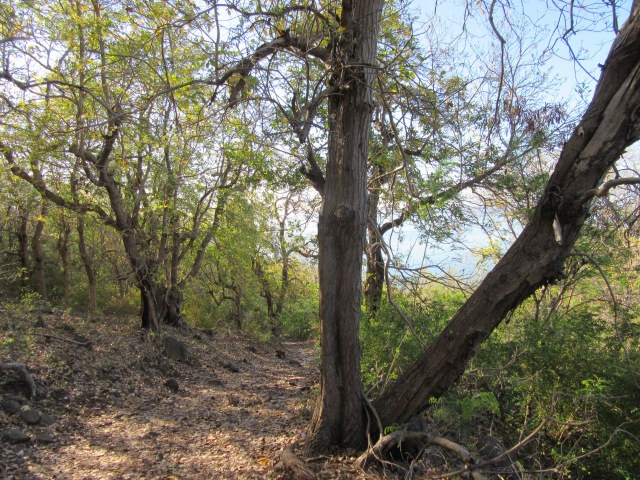
As it turns out, it was actually quite a long walk. I am not a huge fan of walking on tar roads, but I did get there eventually. It is not a beach to swim at, it is very cliffy and beautiful though.
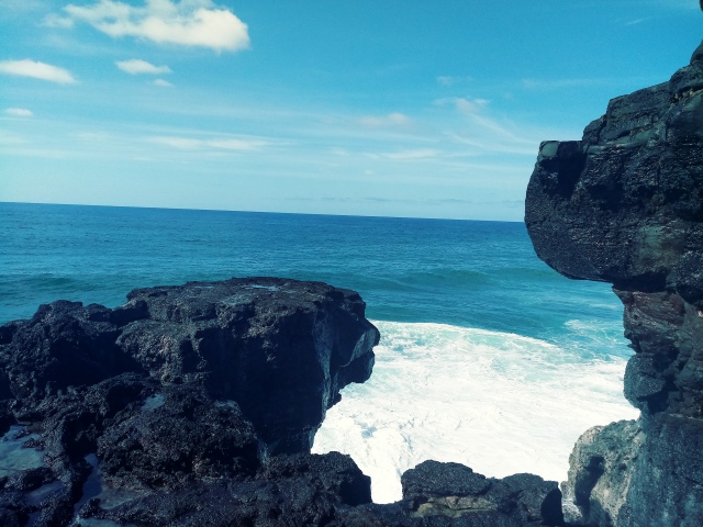
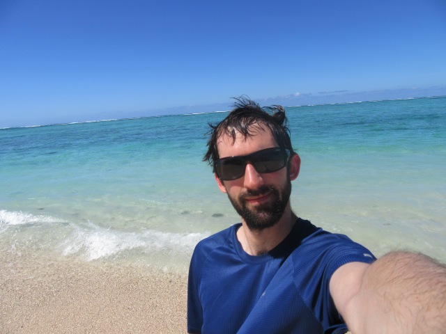
Two points looked equally far south on google, so I decided to visit both. The photo above is known as the Weeping Rocks, which was my preferred candidate. I spent a good half an hour here enjoying nature doing its thing.
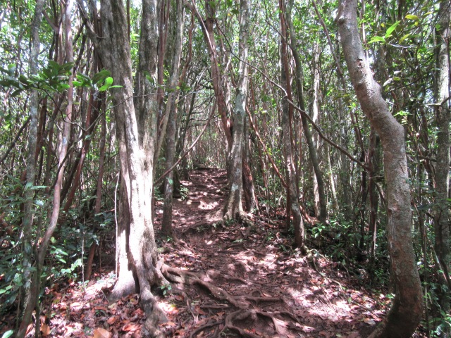
From here I walked back, got in my car and began the long drive to attempt the highest point in Mauritius. The road was surprisingly steep and windy. I eventually found the offices for Black River Gorge National Park, where I was given directions of how to access the highest point. It has an official name of “Piton de la Petite Rivière Noire” – but the shortened English name is “Black River Mountain”.
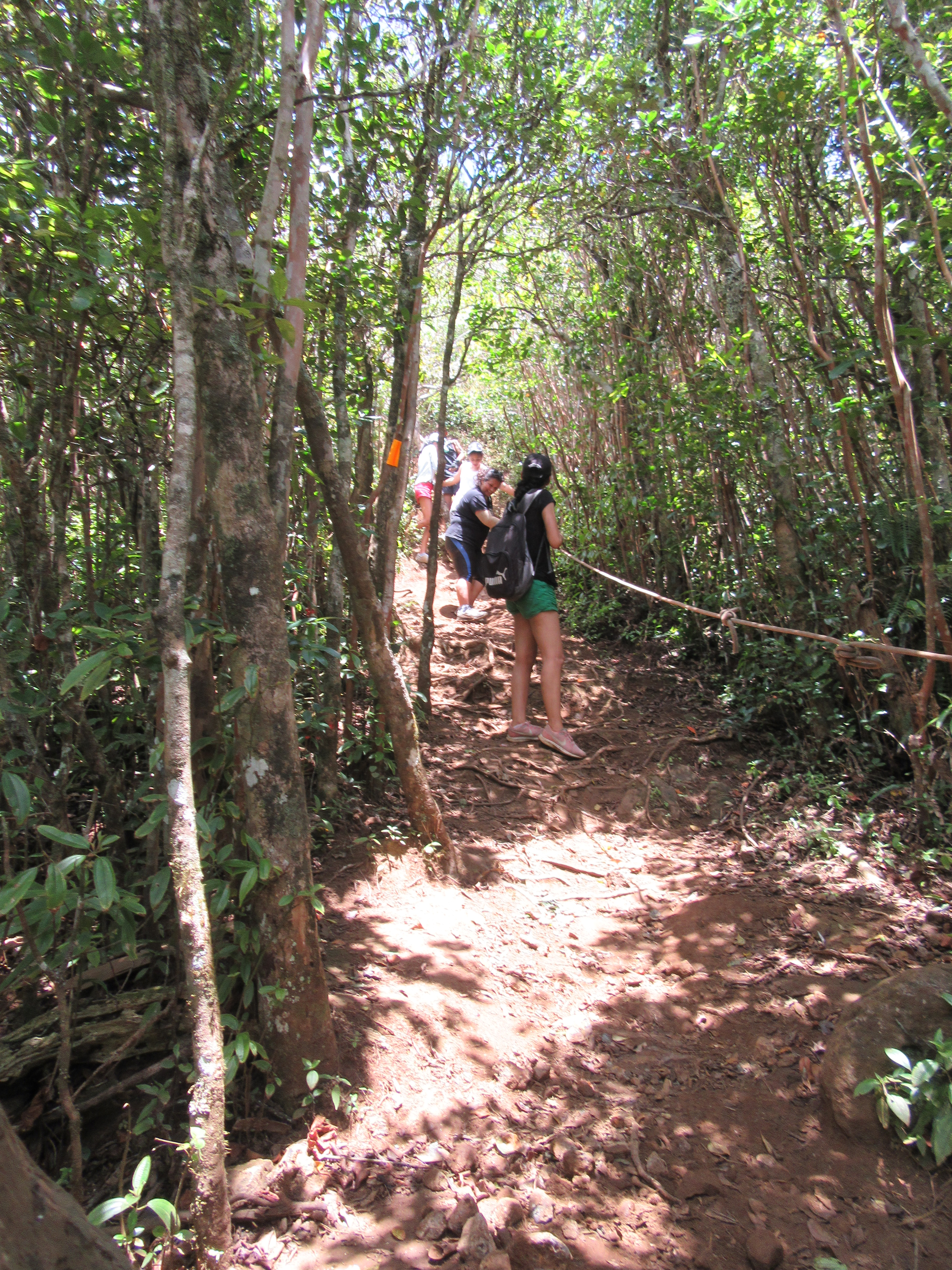
Seeing as the hike started above 500m, and the summit is only 828m, I was expecting a very easy stroll. It is roughly 8km round trip, but the trail follows the ridge line, so there is a lot of up and down. The humidity isn’t nearly as bad on top of the hills as it is down below, but it is still very draining hiking in this weather.
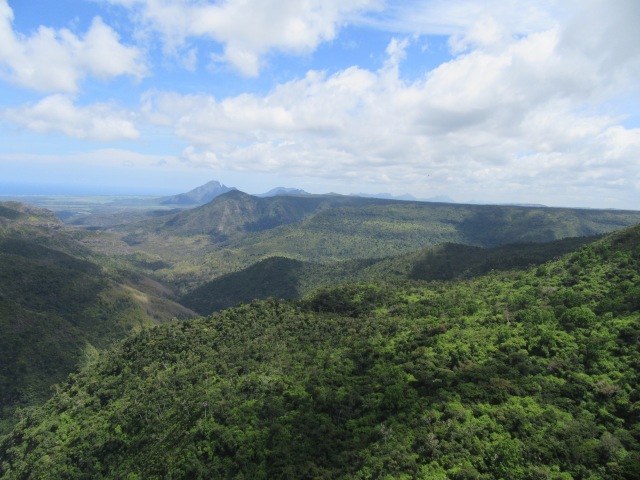
Black River Gorge itself is really beautiful, definitely worth a visit – even if you don’t go hiking there.
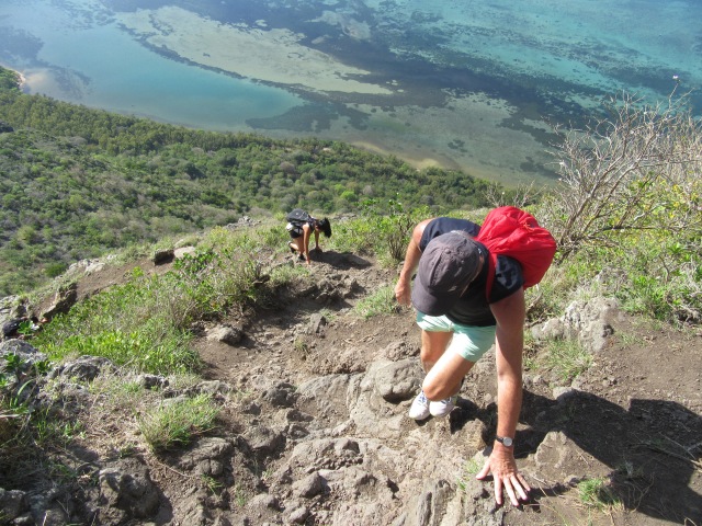
The trail is easy to follow, although you only get a view briefly when there is a gap in vegetation – which isn’t often.
Near the end, there are ropes to hold. I didn’t need them on the way up, but they did facilitate a faster descent.
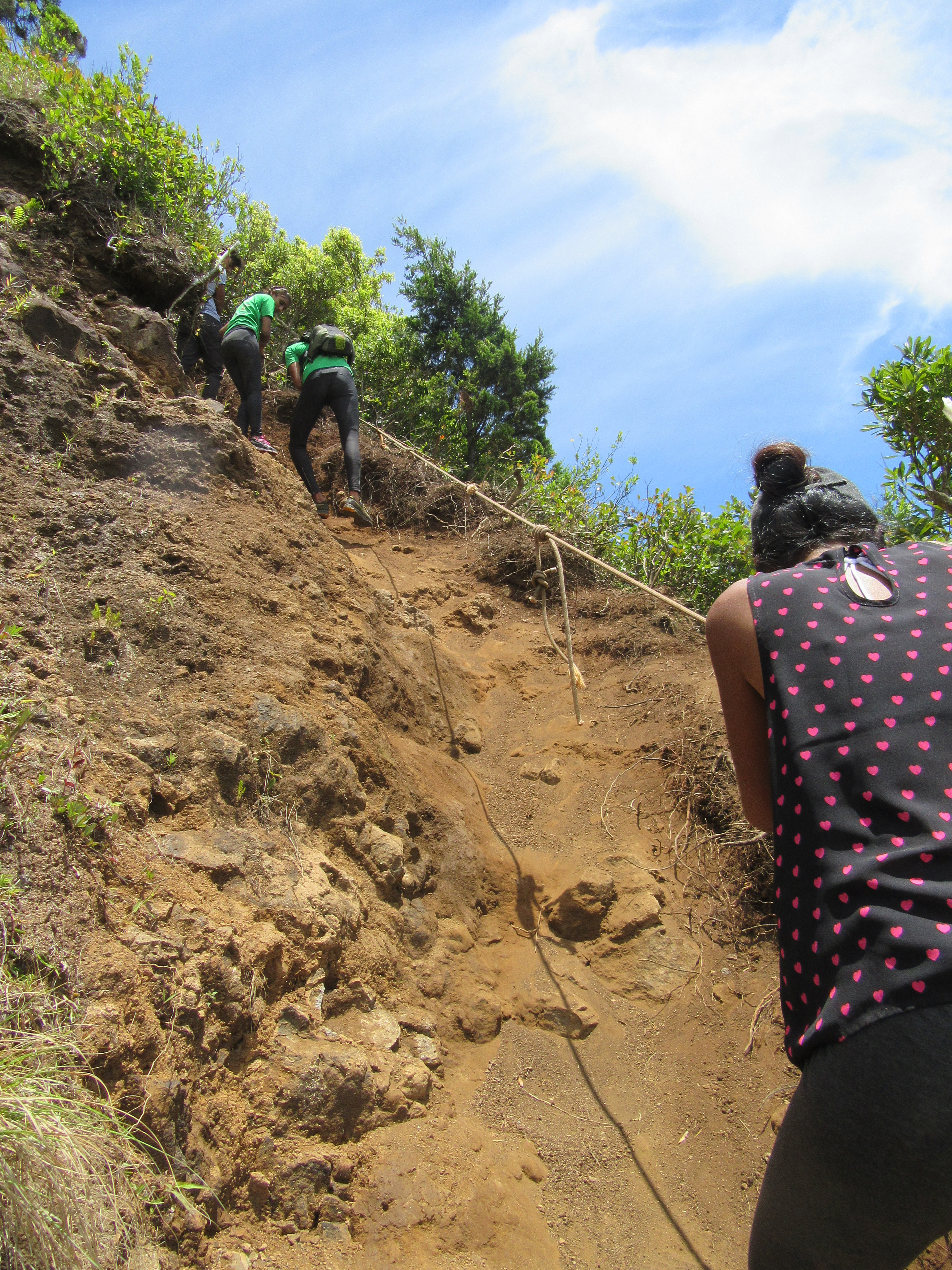
The final section was surprisingly steep. I was learning my first lesson in “don’t assume a route is easy just because it isn’t very high”.
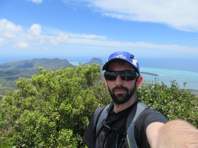
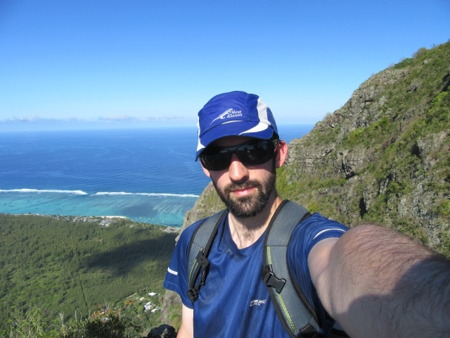
I got my summit selfie, and sat down to munch on some chips – wouldn’t be me if I didn’t have a packet of chips in my pocket!

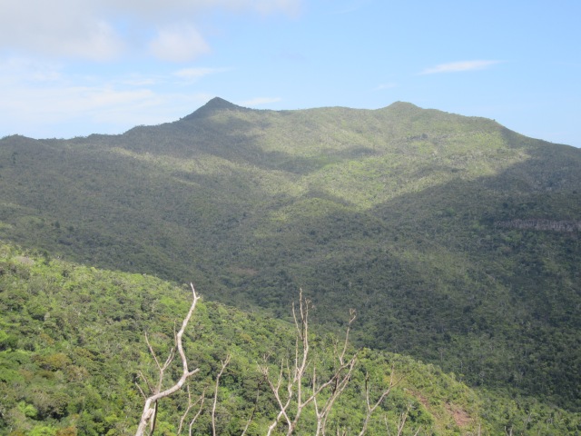
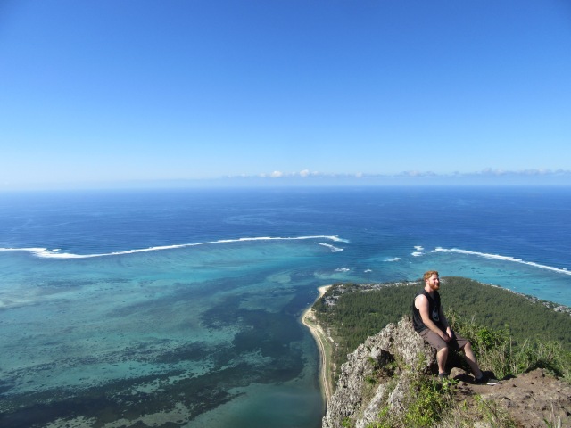
The views from the top were great, well worth the effort.
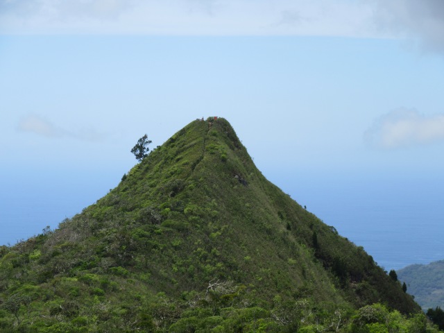
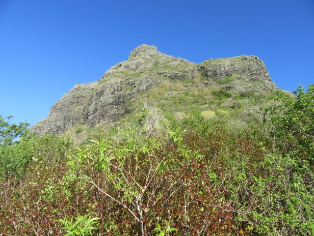
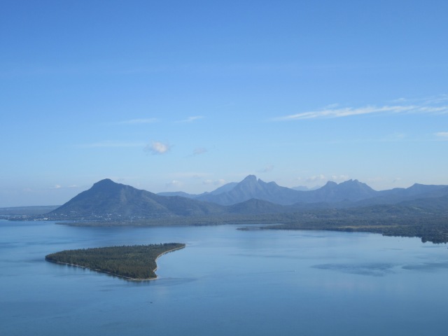
But soon I noticed that the second summit was at least a similar height – so I decided to head up the other summit just in case. My GPS rates the second summit is 2m lower, but no harm done in checking. The photo below is the main summit from just below the second summit.
The hike back proved uneventful, and soon I was back at my car. A relatively flat 8km walk would usually not be an issue for me, but the heat and humidity really drains you.
Next on my to-do list was Grand Bassin – a volcanic crater that is home to numerous Hindu temples, including two massive statues.
I was rather annoyed at the conduct of some of the visitors, parents allowing their children to throw rocks into the water, people taking selfies with statues etc. Out of respect, I will only post one photo of the crater.
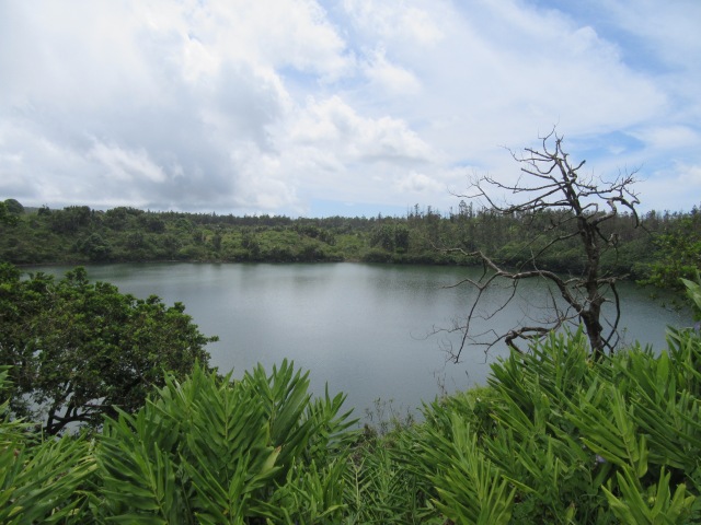
I do highly recommend a visit to the site, it is really beautiful.
I decided to take the scenic route on the drive back, so I drove back via Riviere Des Galets. I stopped at the local supermarket to pick up some supplies before stopping at St Felix Beach.
It was Sunday afternoon, and this beach is clearly very popular with locals – so it was very crowded. I had seen a lot of this up at Black River Gorge as well. It is great to see families having a picnic on a Sunday afternoon. Nonetheless, I am not a huge fan of crowds, so my visit to this beach lasted about as long as it took for me to get my knees wet in the sea, before I got back in my car and continued along.
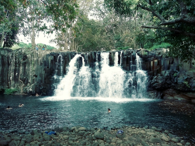
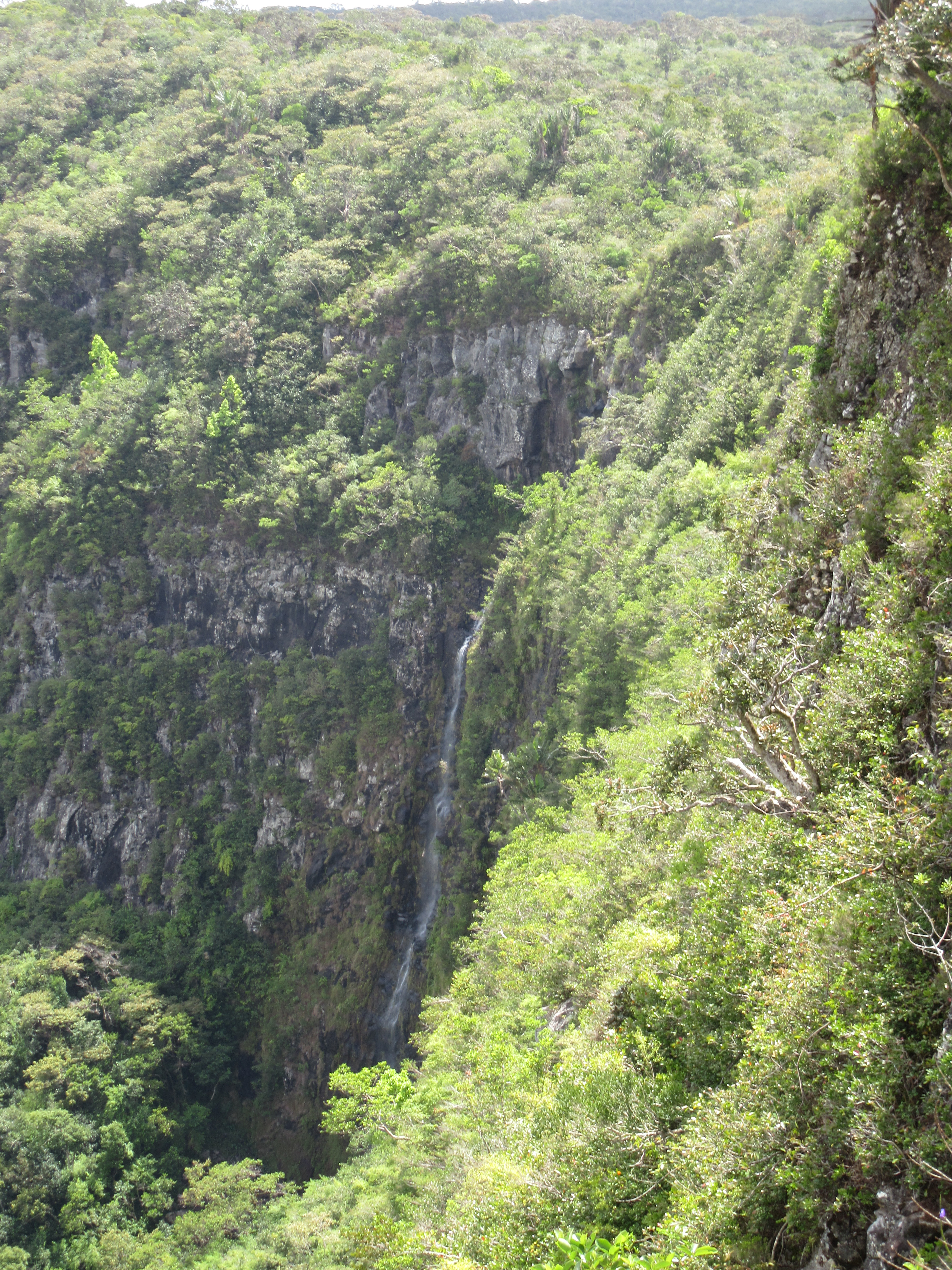
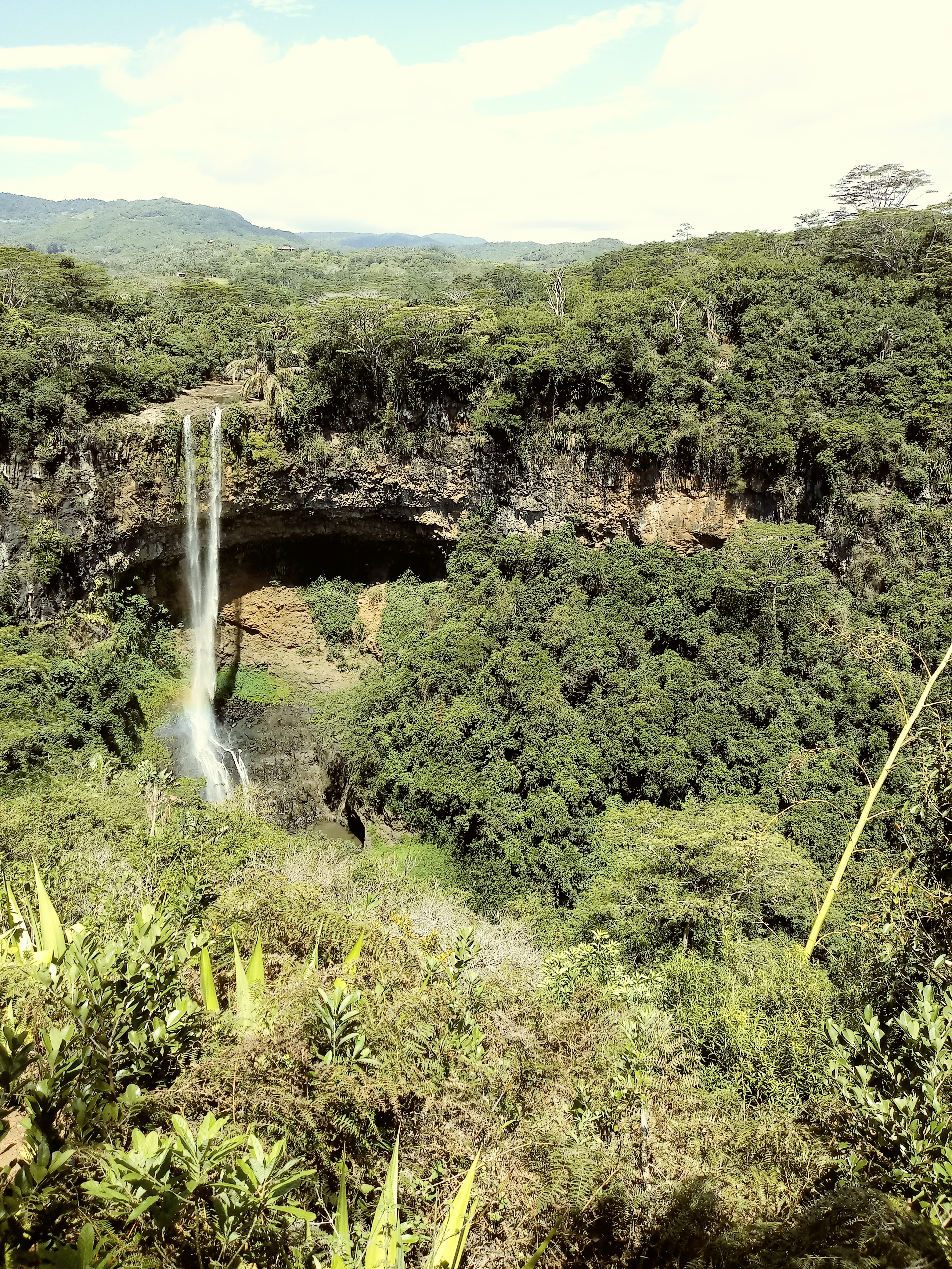
I stopped at Rochester Falls on the way past. The road is a bit dodgy, but nothing my little Eon couldn’t manage. The waterfall isn’t very high, maybe 20m at absolute most, but has a large pool below it. There was a fair crowd below it, but only a few people swimming.
I followed the trail to the top, and then returned to my car. Nothing particularly interesting there, but I guess it only took a few minutes, and it might have been interesting.
Most restaurants were closed, so I ended up getting a chicken curry from a shop near the beach, who were about to close but agreed to make one last meal. Not the best curry I’ve had by any stretch of the imagination, but not the worst either.
Day two had gone well.
Day 3
On the list of what I was most excited about – day 3 included both Le Morne and Chamarel, so I was up at 5am, and in my car by 6.
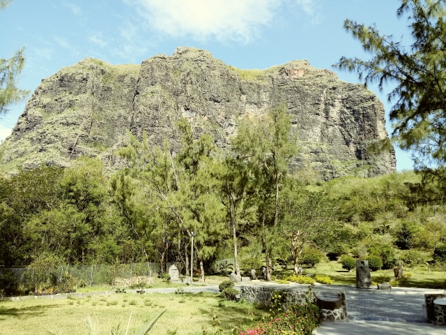
I took the coastal road to Le Morne. I had already seen it from Black River Mountain the day before, but seeing it up close from lower down, it did not disappoint!
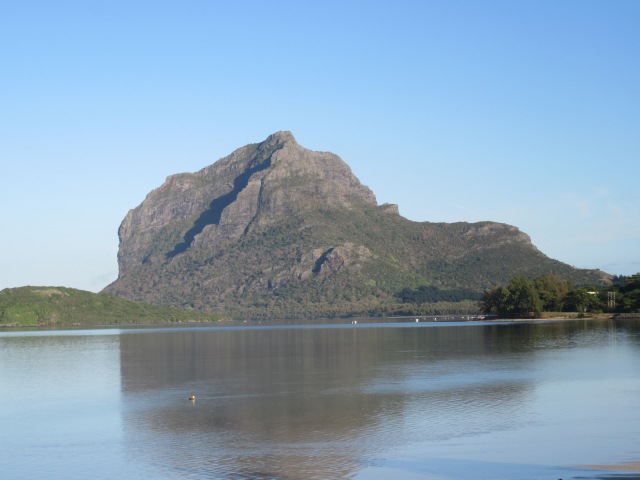
The history of this peak is really sad – and easy to find online, so I won’t write a long story here. The very much shortened version is that escaped slaves used to live on the mountain to avoid being re-captured. When they saw a large number of people approaching, many decided that death was preferable to recapture. The bitter irony being that the people approaching had come to inform them that the slave trade had been abolished and they were now free.
The summit of the peak is protected, being home to numerous plants and animals that are found nowhere else on earth, so you are only allowed to climb to the summit of one of the subsidiary peaks.
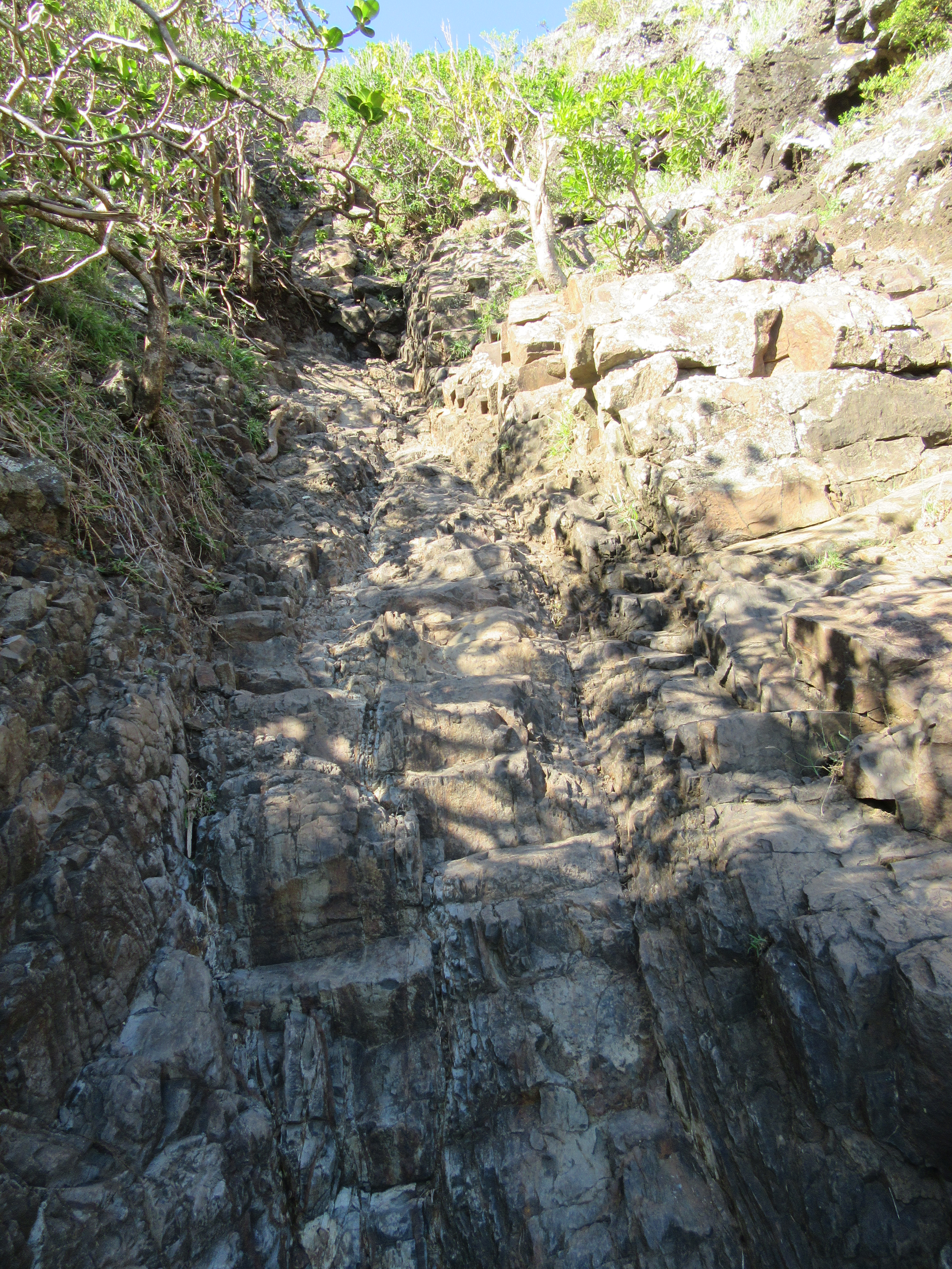
I began the hike around 7am. It was very hot and humid, and my hopes of skipping the crowds were dashed fairly quickly. The trail starts off very wide and easy to follow, although steeper than I anticipated. The route starts at sea level – as in the car park is basically on the beach.
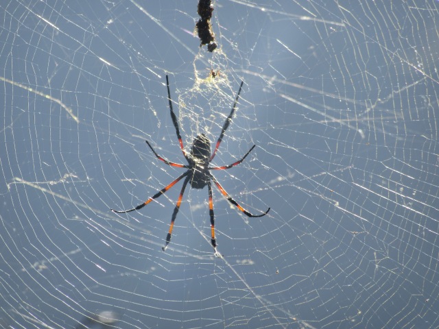
Eventually you reach a sign warning that ascent is dangerous and the trail narrows.
There was a really interesting spider in one of the trees near the sign.
I didn’t find the scrambling particularly difficult, but I know a lot of people turn back around this point. There are a few places where a fall could end badly, but most of the more difficult bits are not near big drops, and the big drops are usually near very easy ground. Overall it didn’t feel unsafe at all – but, once again, I am aware that normal for me and normal for people who don’t often climb mountains are not the same thing.
I had to reluctantly get my high-point selfie by the large cross, because that is as high as you are allowed to go. I got to the summit as 10 people were leaving it. Roughly 30 people were on the summit with me – mostly in guided groups. It seems a bit strange to be a solo hiker in a scenario like that.
Chatting to one of the guides, it turned out that he had lived down the road from me a few years earlier and that we have a few mutual friends. Small world!
Of the summits I did in Mauritius, while I would recommend all of them, I would recommend this one above the rest. The proximity to the sea makes for amazing views.
Descent went off without incident and soon I was back at my car. I took a slow drive around the peak, stopping everywhere I could to get photos of the massive lump of rock. I could probably sit and stare at it all day if I had the time. It is really beautiful.
I proceeded to pass the normal Le Morne Public Beach and parked at the beach more commonly used for fishing. The goal here was simple – I had tagged the southern tip of the island the day before, time to bag the western tip. Of the four corners, this was by far the easiest.
I proceeded to move onto the main Le Morne beach. Notably the one where I am less likely to end up with a fishing hook through my feet!
After a fairly descent amount of time in the water, I decided to move on.
I stopped at the Slave Route Monument before heading off. The lighting of the mountain from this side wasn’t great this early in the morning – which meant I had a good excuse to come back when I was done in Chamarel!
The road from Le Morne to Chamarel is very steep. It is also very narrow. It feels super-dangerous in places.
I soon found myself at Rhumerie de Chamarel. This is a bit of an odd stop for me – as a tea totaler. It isn’t advertised, but if you eat at the restaurant, the tour is free. I didn’t find the tour particularly interesting – but in my line of work, I have seen most of these kinds of machines before, and I already knew most of the process that goes into making rum.
Rum tasting was interesting – I can conclusively say that I don’t want to try rum again! The jam tasting was much more interesting, though.
I proceeded to have a palm heart salad with prawns and juiced pineapple. The food at this restaurant is amazing – if you are doing the factory tour, make sure you eat here as well. The view from the restaurant is also pretty amazing.
Before someone questions me driving after visiting this place – the total rum I consumed was less than a teaspoonfull, more than an hour passed before I left and I had a full meal before leaving. I do not advocate drinking and driving in any circumstances.
I proceeded to the Curious Corner of Chamarel – after buying some lichis from a road-side vendor, naturally. It is strange to find a house of illusions on a hillside in the middle of the Indian Ocean, but there it is. Highly recommended, by the way.
I won’t really comment on the place, rather just share some photos – unfortunately the clarity isn’t always amazing on these:
I then proceeded to answer the question “why did Ghaznavid cross the road?” – the answer being that Chamarel Falls is across the road. Ok, yes, I know that joke was terrible.
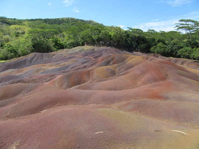
A ticket to visit the falls also gets you access to the 7 Coloured Earth. I overheard someone calling it the “7 coloured construction site” – which I thought was rather funny. Not the most interesting spot ever, but when you are there, you might as well take a look. And for the record – those dramatic shots on google are heavily edited, it looks nothing like that. My photo below is fairly close to what it actually looks like and has not been edited in any way.
Day three had been a good day, but I still wanted my photo of the west face of Le Morne. So I made my way back down and got my shot.
While I was in the area, I decided to make sure the sea was still doing well – you know, for research purposes. Funny to think I voluntarily went into the sea at the same beach twice on the same day!
Upon my return to Souillac, it occurred to me that this was my last night on the south side of the island. From here I would be moving north, closer to the city, but also closer to the large pointy peaks I so badly wanted to stand on top of. I knew the next few days could be really good, but a voice in the back of my head was also reminding me that I was also basically halfway through my holiday in Mauritius.

Love the photos! Looks like a fun trip
Thanks! It was a really awesome trip, it will take a few days to get the entire story up – still 4 days of Mauritius, plus a week of Singapore and 2 weeks of Malaysia left to post!
Cool…I look forward to the posts!! 🙏